Import External Layers
The Import External Layers option allows the user to import a wide variety of different layers, including labeling and geo-referenced maps, XYZ data, ADCP data, DEMs, and sediment cores. Google Maps © standard .KML files may also be imported.
For labels, EE uses a file with the same name as a data file but has a second file with a .LBF extension to save the individual label formats.
To import layers, click on the  button at the bottom of the Layer Control as shown in Figure 1, and the Open External Layer form appears.
To import background images the user should select Georeferenced Images (*.geo; *.jgw; ...) as the data file format, then browse to the image file and click Open button as shown in Figure 2 and Figure 3. After clicking Open button, a background image layer is added to Layer Control as shown in Figure 4.
To import other layers files, the user should select data file format, for example a shoreline ( *.p2d) then browse to the layer file and click Open button. After clicking Open button, a layer is added to Layer Control as shown in Figure 5.
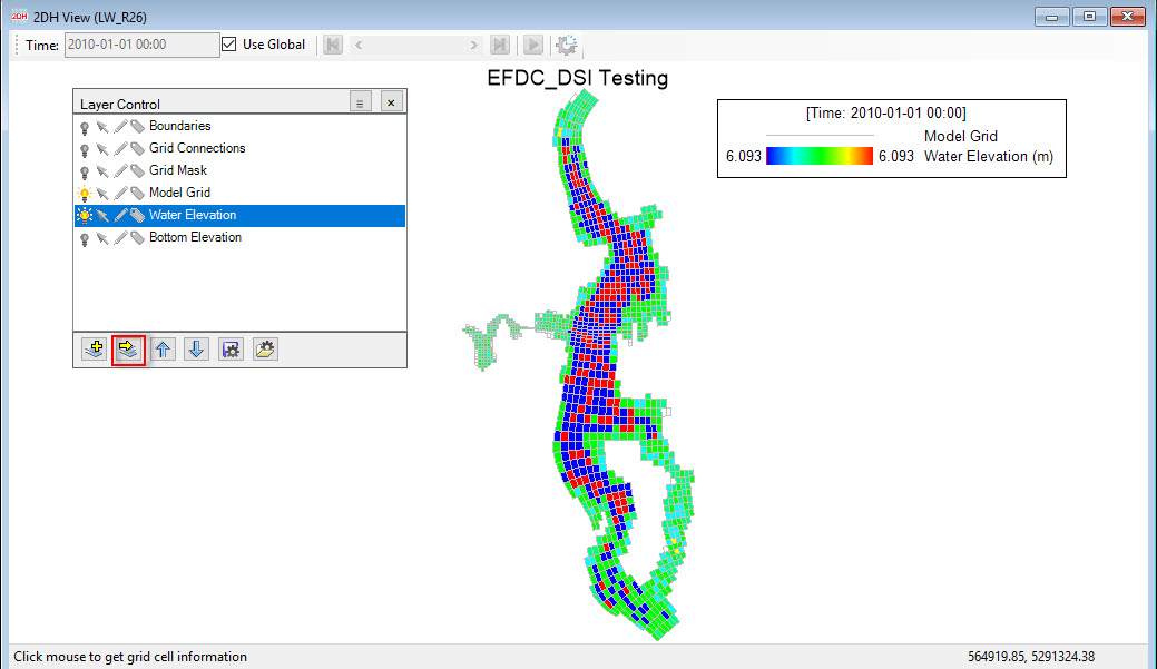
Figure 1. Import an external overlay layer.
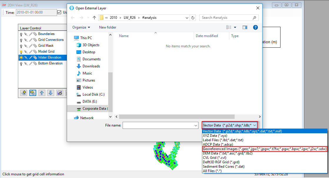
Figure 2. Select format file for background image.
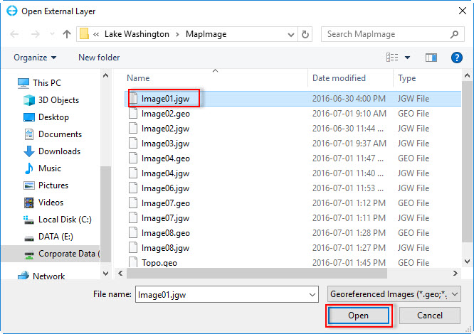
Figure 3. Open background image file.
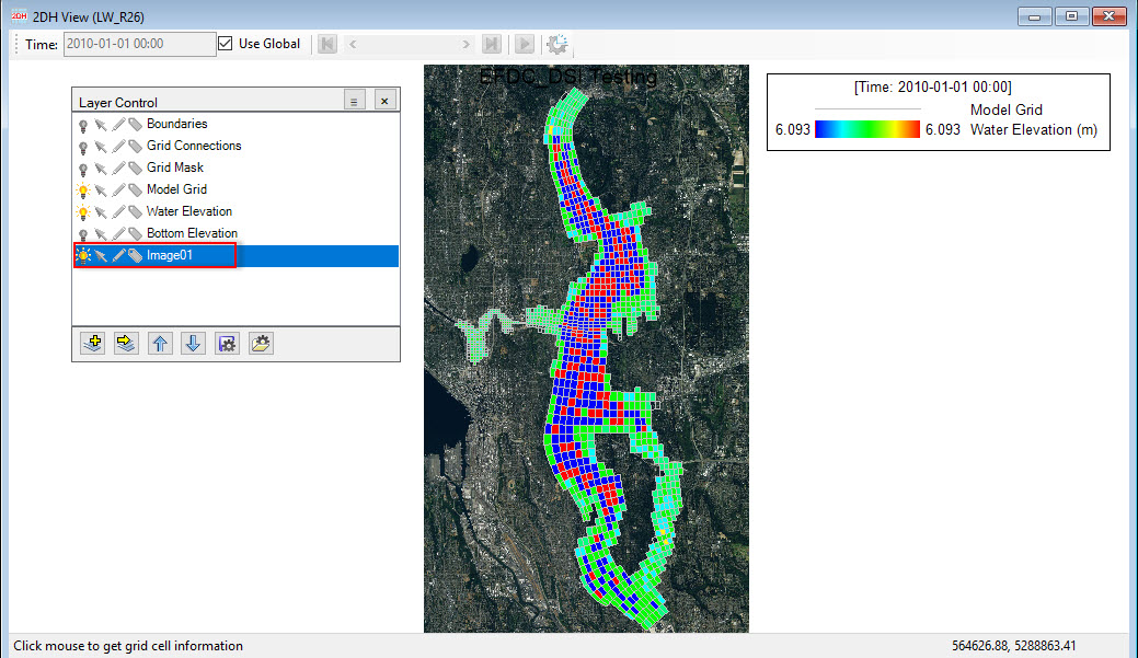
Figure 4. Background image added to Layer Control and displayed in 2DH View.
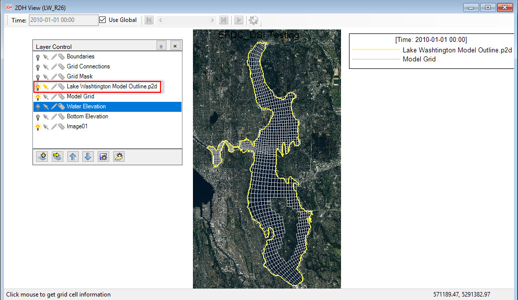
Figure 5. An overlay layer added to Layer Control and displayed in 2DH View.