The DTM Color Ramp frame deals with elevation and the color gradients to represent different elevations. If the user is only using a 2D polygon then this section is irrelevant. Figure 4 46 shows this section for reference.
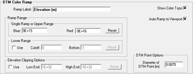
Figure 4 46 DTM color ramp sub-sections.
Ramp Label |
Give the color ramp a name |
Single Ramp or Upper Range |
Specifies the range of color from blue to red |
Lower Range |
Specifies the lower range of the color ramp |
Show Color Topo |
Shows the elevation topography in color based on the color ramp. |
Auto Ramp to Viewport |
Change Min, Max, and Average number of View Options "Ortho", "Dx", and "Dy" on Legend when view window changed. |
Elevation Clipping Options |
Specifies the elevation range for clipping |
DTM Point Options |
Allow the user set the diameter of DTM Points in inches |