The Model Gird tab is shown in Figure 1 and provides the user the summary of model domain such as Grid Type, Number of Grid Cells, Number of Sediment/Water Layers of the model as well as a location and size of model like area, dimension, UTM Zone, etc. There are two sub-tab in this section Grid and Layers, they will be described below.
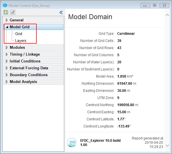
Figure 1. Model Grid.