CVLGrid allows the user to load a Digital Terrain Model file (DTM) into the workspace. A DTM is a simple X, Y, Z ASCII file that contains information of coordinates and terrain elevation. It may be accessed with the DTM Menu button as shown in Figure 4 19 .
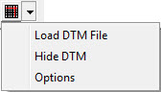
Figure 4 19 DTM dropdown menu.
Manage space
Manage content
Integrations