Similar to posting files, label files contain coordinate data that link a text label to a specific location. This tool can be used to label stations (posts) in the workspace that do not have labels or to label geographic features important to the project. This tool can be used by selecting the Label Options button shown in Figure 4 52.
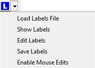
Figure 4 52 Label menu options.
Manage space
Manage content
Integrations